Delwedd:Ambleston1.jpg
Ambleston1.jpg ((640 × 480 picsel, maint y ffeil: 54 KB, ffurf MIME: image/jpeg))
Crynodeb
| Disgrifiad |
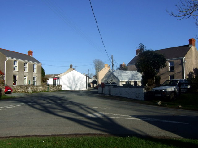
English: Treamlod/Ambleston village centre Tiny agricultural village (popn. 150) south of the Preselis.
From the community action plan 2005: "Despite Flemish settlements typical of Pembrokeshire roundabout Ambleston Parish, and despite more recent population changes, the character of Ambleston is decidedly Welsh. It would be wrong to include it in the dubious Little England beyond Wales description applied to South Pembrokeshire; mostly by travel brochures. The illdefined Landsker probably lies to the south of Ambleston although some historians have associated it with Woodstock. Most families rooted in the area are Welsh speaking and many use Welsh by choice." Ambleston has no pub, school or shops, although it used to have several. There is concern about the lack of amenities in the village and efforts are being made to restore community activities. |
| Dyddiad | |
| Ffynhonnell | From geograph.org.uk |
| Awdur | ceridwen |
| Cydnabyddiaeth (required by the license) | ceridwen / Treamlod/Ambleston village centre / |
| Camera location | | View this and other nearby images on: OpenStreetMap |
|---|
Trwyddedu

|
This image was taken from the Geograph project collection. See this photograph's page on the Geograph website for the photographer's contact details. The copyright on this image is owned by ceridwen and is licensed for reuse under the Creative Commons Attribution-ShareAlike 2.0 license.
|
- Mae'n rhydd i chi:
- rhannu – gallwch gopïo, dosbarthu a throsglwyddo'r gwaith
- ailwampio – gallwch addasu'r gwaith
- Ar yr amodau canlynol:
- cydnabyddiaeth – Mae'n rhaid i chi nodi manylion y gwaith hwn, rhoi dolen i'r drwydded, a nodi os y bu golygu arni, yn y modd a benwyd gan yr awdur neu'r trwyddedwr (ond heb awgrymu o gwbl eu bod yn eich cymeradwyo chi na'ch defnydd o'r gwaith).
- rhannu ar dermau tebyg – Os byddwch yn addasu'r gwaith hwn, neu yn ei drawsnewid, neu yn adeiladu arno, mae'n rhaid i chi ddosbarthu'r gwaith dan drwydded sy'n union yr un fath same a'r gwreiddiol.
Hanes y ffeil
Cliciwch ar ddyddiad / amser i weld y ffeil fel ag yr oedd bryd hynny.
| Dyddiad / Amser | Bawdlun | Hyd a lled | Defnyddiwr | Sylw | |
|---|---|---|---|---|---|
| cyfredol | 19:21, 9 Tachwedd 2009 | | 640 × 480 (54 KB) | Perry Rimmer | {{Information |Description={{en|1=h}} |Source=h |Author=h |Date=h |Permission= |other_versions= }} |
Cysylltiadau'r ffeil
Mae'r 1 tudalennau a ddefnyddir isod yn cysylltu i'r ddelwedd hon:
Defnydd cydwici y ffeil
Mae'r wicis eraill hyn yn defnyddio'r ffeil hon:
- Y defnydd ar ceb.wikipedia.org
- Y defnydd ar en.wikipedia.org
- Y defnydd ar eu.wikipedia.org
- Y defnydd ar fa.wikipedia.org
- Y defnydd ar gd.wikipedia.org
- Y defnydd ar kw.wikipedia.org
- Y defnydd ar www.wikidata.org