Delwedd:AndamanSeaNASA1.jpg
Maint y rhagolwg: 475 × 599 picsel. Eglurdebau eraill: 190 × 240 picsel | 380 × 480 picsel | 850 × 1,072 picsel.
Maint llawn ((850 × 1,072 picsel, maint y ffeil: 246 KB, ffurf MIME: image/jpeg))
Crynodeb
| Disgrifiad |
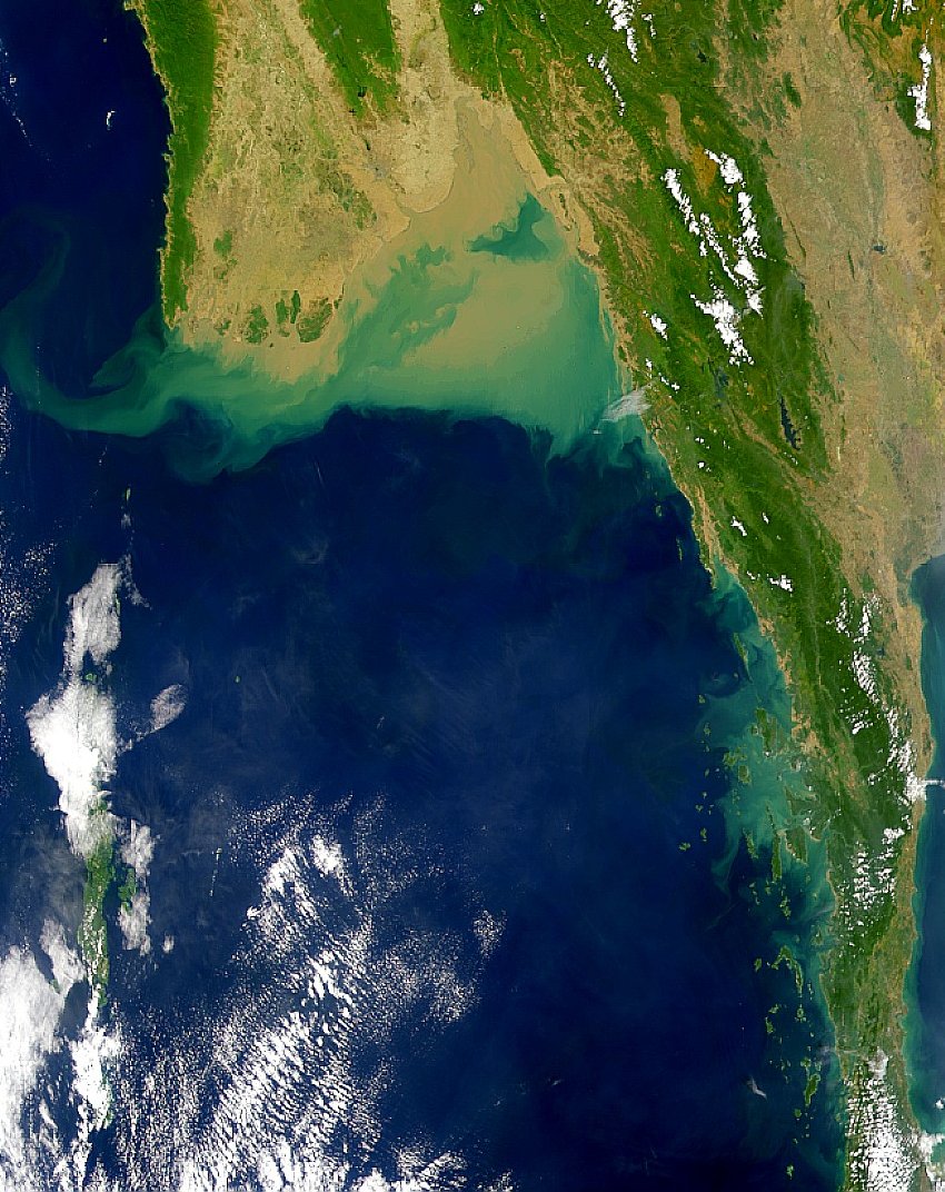
English: Satellite image of the Andaman Sea showing the green-algae and silt deposits due to the Irrawaddy River in its northern part |
| Dyddiad | |
| Ffynhonnell | http://visibleearth.nasa.gov/view_rec.php?id=948 |
| Awdur | NASA |
Trwyddedu
| This file is in the public domain in the United States because it was solely created by NASA. NASA copyright policy states that "NASA material is not protected by copyright unless noted". (See Template:PD-USGov, NASA copyright policy page or JPL Image Use Policy.) | ||
 |
Warnings:
|
Hanes y ffeil
Cliciwch ar ddyddiad / amser i weld y ffeil fel ag yr oedd bryd hynny.
| Dyddiad / Amser | Bawdlun | Hyd a lled | Defnyddiwr | Sylw | |
|---|---|---|---|---|---|
| cyfredol | 10:05, 14 Medi 2010 | | 850 × 1,072 (246 KB) | Materialscientist | {{Information |Description={{en|1=Satellite image of the Andaman Sea showing the green-algae and silt deposits due to the Irrawaddy River in its northern part}} |Source=http://visibleearth.nasa.gov/view_rec.php?id=948 |Author=NASA |Date=1999-12-30 |Permi |
Cysylltiadau'r ffeil
Mae'r 1 tudalennau a ddefnyddir isod yn cysylltu i'r ddelwedd hon:
Defnydd cydwici y ffeil
Mae'r wicis eraill hyn yn defnyddio'r ffeil hon:
- Y defnydd ar af.wikipedia.org
- Y defnydd ar ar.wikipedia.org
- Y defnydd ar ast.wikipedia.org
- Y defnydd ar ba.wikipedia.org
- Y defnydd ar blk.wikipedia.org
- Y defnydd ar ca.wikipedia.org
- Y defnydd ar ceb.wikipedia.org
- Y defnydd ar el.wikipedia.org
- Y defnydd ar en.wikipedia.org
- Y defnydd ar eo.wikipedia.org
- Y defnydd ar es.wikipedia.org
- Y defnydd ar fr.wikipedia.org
- Y defnydd ar fy.wikipedia.org
- Y defnydd ar gl.wikipedia.org
- Y defnydd ar hak.wikipedia.org
- Y defnydd ar hy.wikipedia.org
- Y defnydd ar it.wikipedia.org
- Y defnydd ar mr.wikipedia.org
- Y defnydd ar ms.wikipedia.org
- Y defnydd ar mzn.wikipedia.org
- Y defnydd ar no.wikipedia.org
- Y defnydd ar oc.wikipedia.org
- Y defnydd ar pl.wikipedia.org
- Y defnydd ar ro.wikipedia.org
- Y defnydd ar ru.wikipedia.org
- Y defnydd ar sl.wikipedia.org
- Y defnydd ar sr.wikipedia.org
- Y defnydd ar th.wikipedia.org
- Y defnydd ar tr.wikipedia.org
- Y defnydd ar uk.wikipedia.org
- Y defnydd ar www.wikidata.org