Delwedd:Bodensee satellit.jpg

Maint y rhagolwg: 800 × 496 picsel. Eglurdebau eraill: 320 × 198 picsel | 640 × 397 picsel | 1,024 × 635 picsel | 1,394 × 864 picsel.
Maint llawn ((1,394 × 864 picsel, maint y ffeil: 224 KB, ffurf MIME: image/jpeg))
Crynodeb
| Disgrifiad |
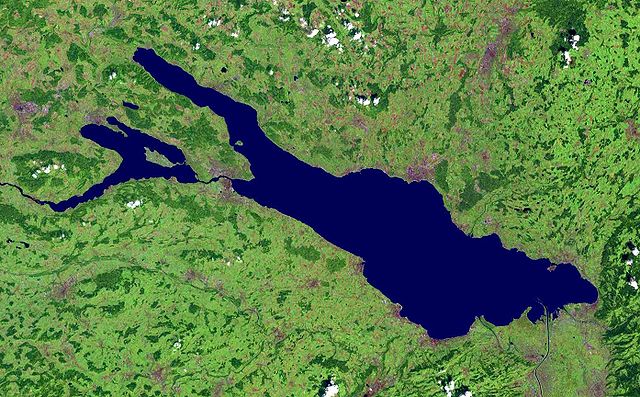
Deutsch: Satellitenaufnahme vom Bodensee |
| Dyddiad | before 17 Awst 2005 |
| Ffynhonnell | from NASA World Wind - Free Satellite Image |
| Awdur | NASA |
Crynodeb
| This image is in the public domain because it is a screenshot from NASA’s globe software World Wind using a public domain layer, such as Blue Marble, MODIS, Landsat, SRTM, USGS or GLOBE.
|
 |
Hanes y ffeil
Cliciwch ar ddyddiad / amser i weld y ffeil fel ag yr oedd bryd hynny.
| Dyddiad / Amser | Bawdlun | Hyd a lled | Defnyddiwr | Sylw | |
|---|---|---|---|---|---|
| cyfredol | 15:28, 1 Rhagfyr 2005 | | 1,394 × 864 (224 KB) | Wiki-vr | enhanced |
| 00:44, 17 Awst 2005 |  | 1,394 × 864 (138 KB) | APPER | * Satellitenaufnahme vom Bodensee * from Nasa World Wind - Free Satellite Image {{PD-USGov}} |
Cysylltiadau'r ffeil
Nid oes tudalennau'n defnyddio'r ffeil hon.
Defnydd cydwici y ffeil
Mae'r wicis eraill hyn yn defnyddio'r ffeil hon:
- Y defnydd ar af.wikipedia.org
- Y defnydd ar als.wikipedia.org
- Y defnydd ar arz.wikipedia.org
- Y defnydd ar az.wikipedia.org
- Y defnydd ar ba.wikipedia.org
- Y defnydd ar bg.wikipedia.org
- Y defnydd ar bs.wikipedia.org
- Y defnydd ar ceb.wikipedia.org
- Y defnydd ar da.wikipedia.org
- Y defnydd ar de.wikipedia.org
- Bodensee
- Benutzer:Itta
- Mainau
- Reichenau (Insel)
- Benutzer:Rhinux
- Hoy (Bodensee)
- Werd (Bodensee)
- Benutzer:Marcel601
- Benutzer:Ralfonso
- Seerhein
- Benutzer:Trinityfolium
- Benutzer:Vorlage/Herkunftsvorlagen
- Benutzer:NicolasK
- Benutzer:Sir.toby
- Benutzer:Manerr
- Benutzer:NetCuRLi
- Galgeninsel
- Benutzer:Vorlage/vom Bodensee
- Benutzer:Shippo~dewiki
- Benutzer:Mkt.berlin88
- Benutzer:Mk-fn
- Benutzer:Widipedia
- Benutzer:Zollernalb
- Portal:Ungarn/Quiz
- Benutzer:Manu-LA
- Benutzer:Vorlage/Herkunftsvorlagen/Baden-Württemberg
- Benutzer:Vorlage/Herkunftsvorlagen/Bayern
- Bodensee-Rundweg
- Benutzer:TwilightFreak
- Benutzer:Master baerr
- Benutzer:MP Trixi
- Benutzer:Weber Mi
- Benutzer:Hintze
- Benutzer:KMJagger
- Benutzer:Sweet Chily
- Benutzer:Maasty
- Benutzer:Rudolf von Rheinfelden/Labor/Artikelbaustelle 2
Gweld rhagor o'r defnydd cydwici o'r ffeil hon.