Delwedd:Charente department location map.svg

Maint rhagolwg PNG o ffeil SVG yw: 634 × 600 picsel. Eglurdebau eraill: 254 × 240 picsel | 507 × 480 picsel | 812 × 768 picsel | 1,082 × 1,024 picsel | 2,165 × 2,048 picsel | 1,095 × 1,036 picsel.
Maint llawn (Ffeil SVG, maint mewn enw 1,095 × 1,036 picsel, maint y ffeil: 184 KB)
Crynodeb
| Camera location | | View this and other nearby images on: OpenStreetMap |
|---|
| Disgrifiad |
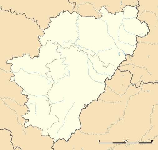
English: Blank administrative map of the department of Charente, France, for geo-location purpose, with distinct boundaries for regions, departments and arrondissements.
Français : Carte administrative vierge du département de Charente, France, destinée à la géolocalisation, avec limite distincte des régions, départements et arrondissements. Approximate scale: 1:440,000 (precision: 110 m)
Geographic limits of the map:
|
||
| Dyddiad | |||
| Ffynhonnell |
Gwaith yr uwchlwythwr
|
||
| Awdur | Eric Gaba (Sting - fr:Sting) | ||
| Caniatâd (Ailddefnyddio'r ffeil hon) |
|
||
| Diwygiadau eraill |
|

Trwyddedu
Yr wyf fi, deiliad yr hawlfraint ar y gwaith hwn, yn ei gyhoeddi yn ôl termau'r trwyddedau a ganlyn:
Trwyddedir y ffeil hon yn ôl termau'r drwydded Creative Commons Attribution-Share Alike 3.0 Unported.
- Mae'n rhydd i chi:
- rhannu – gallwch gopïo, dosbarthu a throsglwyddo'r gwaith
- ailwampio – gallwch addasu'r gwaith
- Ar yr amodau canlynol:
- cydnabyddiaeth – Mae'n rhaid i chi nodi manylion y gwaith hwn, rhoi dolen i'r drwydded, a nodi os y bu golygu arni, yn y modd a benwyd gan yr awdur neu'r trwyddedwr (ond heb awgrymu o gwbl eu bod yn eich cymeradwyo chi na'ch defnydd o'r gwaith).
- rhannu ar dermau tebyg – Os byddwch yn addasu'r gwaith hwn, neu yn ei drawsnewid, neu yn adeiladu arno, mae'n rhaid i chi ddosbarthu'r gwaith dan drwydded sy'n union yr un fath same a'r gwreiddiol.

|
Caniateir copïo, dosbarthu a/neu golygu'r ddogfen hon yn ôl telerau'r Drwydded Ddogfennaeth Rydd GNU, Fersiwn 1.2 neu unrhyw fersiwn diweddarach a gyhoeddwyd gan y Free Software Foundation; yn cynnwys dim Adrannau Di-syfl, dim Testunau Clawr Blaen, a dim Testunau Clawr Cefn. Cynhwysir copi o'r drwydded hon yn yr adran Trwydded Ddogfennaeth Rydd GNU". |
Gallwch ddewis y drwydded y mynnwch.
Hanes y ffeil
Cliciwch ar ddyddiad / amser i weld y ffeil fel ag yr oedd bryd hynny.
| Dyddiad / Amser | Bawdlun | Hyd a lled | Defnyddiwr | Sylw | |
|---|---|---|---|---|---|
| cyfredol | 16:03, 15 Hydref 2008 | | 1,095 × 1,036 (184 KB) | Sting | == Summary == {{Location|45|39|45|N|00|15|00|E|scale:1000000}} <br/> {{Information |Description={{en|Blank administrative map of the department of Charente, France, for geo-location purpose, with distinct boundaries for regions, departmen |
Cysylltiadau'r ffeil
Mae'r 1 tudalennau a ddefnyddir isod yn cysylltu i'r ddelwedd hon:
Defnydd cydwici y ffeil
Mae'r wicis eraill hyn yn defnyddio'r ffeil hon:
- Y defnydd ar als.wikipedia.org
- Y defnydd ar ar.wikipedia.org
- Y defnydd ar ceb.wikipedia.org
- Y defnydd ar de.wikipedia.org
- Wikipedia:Kartenwerkstatt/Positionskarten/Europa
- Vorlage:Positionskarte Frankreich Charente
- Stade Camille-Lebon
- Roc-de-Sers
- Militärflugplatz Cognac-Châteaubernard
- Grotte du Placard
- Grotte de Montgaudier
- Grotte de Fontéchevade
- Grotte du Visage
- Abri du Bois-du-Roc
- Grottes du Quéroy
- Grotte d’Artenac
- Grotte des Perrats
- Y defnydd ar el.wikipedia.org
- Y defnydd ar en.wikipedia.org
- Y defnydd ar eo.wikipedia.org
- La Rochefoucauld (Charente)
- Jarnac
- Ŝablono:Situo sur mapo Francio Charente
- Angoulême (stacidomo)
- Cognac (stacidomo)
- Ruffec (stacidomo)
- Chabanais (stacidomo)
- La Rochefoucauld (stacidomo)
- La Rochefoucauld-en-Angoumois
- Jarnac (stacidomo)
- Mainxe-Gondeville
- Gondeville
- Châteauneuf-sur-Charente (stacidomo)
- Châteauneuf-sur-Charente
- Chalais (stacidomo)
- Chalais (Charente)
- Montmoreau (stacidomo)
- Saint-Amant-de-Montmoreau
- Montmoreau
- Luxé (stacidomo)
- Ruelle (stacidomo)
- Ruelle-sur-Touvre
- Chasseneuil-sur-Bonnieure (stacidomo)
- Roumazières-Loubert (stacidomo)
- Roumazières-Loubert
- Exideuil-sur-Vienne (stacidomo)
- Saillat - Chassenon (stacidomo)
- Gond-Pontouvre
- Saint-Michel-sur-Charente (stacidomo)
- Saint-Michel (Charente)
Gweld rhagor o'r defnydd cydwici o'r ffeil hon.