Delwedd:Connecticut-counties-map.gif
Wedi ei chwyddo hyd yr eithaf.
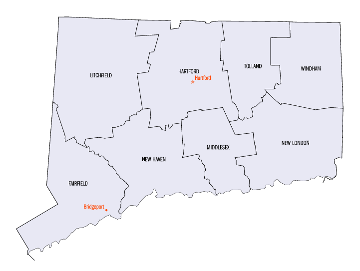
Connecticut-counties-map.gif ((721 × 543 picsel, maint y ffeil: 14 KB, ffurf MIME: image/gif))

|
This locator map image could be re-created using vector graphics as an SVG file. This has several advantages; see Commons:Media for cleanup for more information. If an SVG form of this image is available, please upload it and afterwards replace this template with
{{vector version available|new image name}}.
It is recommended to name the SVG file “Connecticut-counties-map.svg”—then the template Vector version available (or Vva) does not need the new image name parameter. |
Crynodeb
| Disgrifiad | The image was downloaded from en.wiki (en:Image:Connecticut-counties-map.gif) under the {{PD-USGov}} license tag. Wars 05:30, 12 September 2006 (UTC) | ||||||
| Ffynhonnell | http://www.fedstats.go Archieved version | ||||||
| Awdur | Federal Committee on Statistical Methodology | ||||||
| Caniatâd (Ailddefnyddio'r ffeil hon) |
|
||||||

Trwyddedu
| Trwyddedir y ffeil hon yn ôl termau'r drwydded Creative Commons Attribution-Share Alike 3.0 Unported. Subject to disclaimers. | ||
| ||
| Ychwangwyd y nod trwyddedu hwn wrth y ffeil hon yn ran o'r gwaith o ddiweddaru trwyddedau GFDL. |

|
Caniateir copïo, dosbarthu a/neu golygu'r ddogfen hon yn ôl telerau'r Drwydded Ddogfennaeth Rydd GNU, Fersiwn 1.2 neu unrhyw fersiwn diweddarach a gyhoeddwyd gan y Free Software Foundation; yn cynnwys dim Adrannau Di-syfl, dim Testunau Clawr Blaen, a dim Testunau Clawr Cefn. Cynhwysir copi o'r drwydded hon yn yr adran Trwydded Ddogfennaeth Rydd GNU". Subject to disclaimers. |
Hanes y ffeil
Cliciwch ar ddyddiad / amser i weld y ffeil fel ag yr oedd bryd hynny.
| Dyddiad / Amser | Bawdlun | Hyd a lled | Defnyddiwr | Sylw | |
|---|---|---|---|---|---|
| cyfredol | 18:14, 15 Mai 2010 | | 721 × 543 (14 KB) | DieBuche | fix |
| 05:25, 12 Medi 2006 | Dim bawdlun | (16 KB) | Wars | The image was downloaded from en.wiki (en:Image:Connecticut-counties-map.gif) under the '''<nowiki>/nowiki<>''' license tag. ~~~~ |
Cysylltiadau'r ffeil
Mae'r 1 tudalennau a ddefnyddir isod yn cysylltu i'r ddelwedd hon:
Defnydd cydwici y ffeil
Mae'r wicis eraill hyn yn defnyddio'r ffeil hon:
- Y defnydd ar ar.wikipedia.org
- Y defnydd ar de.wikipedia.org
- Y defnydd ar en.wikipedia.org
- Y defnydd ar es.wikipedia.org
- Y defnydd ar fi.wikipedia.org
- Y defnydd ar frr.wikipedia.org
- Y defnydd ar fr.wikipedia.org
- Y defnydd ar he.wikipedia.org
- Y defnydd ar hu.wikipedia.org
- Y defnydd ar id.wikipedia.org
- Y defnydd ar it.wikipedia.org
- Y defnydd ar ja.wikipedia.org
- Y defnydd ar ko.wikipedia.org
- Y defnydd ar no.wikipedia.org
- Y defnydd ar pl.wikipedia.org
- Y defnydd ar pt.wikipedia.org
- Y defnydd ar ru.wikipedia.org
- Y defnydd ar simple.wikipedia.org
- Y defnydd ar sq.wikipedia.org
- Y defnydd ar sv.wikipedia.org
- Y defnydd ar ur.wikipedia.org
- Y defnydd ar zh.wikipedia.org