Delwedd:Dengue06.png
Maint y rhagolwg: 800 × 435 picsel. Eglurdebau eraill: 320 × 174 picsel | 640 × 348 picsel | 1,161 × 631 picsel.
Maint llawn ((1,161 × 631 picsel, maint y ffeil: 42 KB, ffurf MIME: image/png))

|
This health map image could be re-created using vector graphics as an SVG file. This has several advantages; see Commons:Media for cleanup for more information. If an SVG form of this image is available, please upload it and afterwards replace this template with
{{vector version available|new image name}}.
It is recommended to name the SVG file “Dengue06.svg”—then the template Vector version available (or Vva) does not need the new image name parameter. |
Crynodeb
| Disgrifiad |
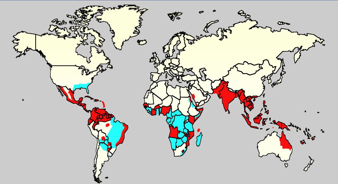
English: Map showing the distribution of dengue fever in the world, as of 2006. Map produced by the Agricultural Research Service of the US Department of Agriculture.
Key:
|
| Ffynhonnell |
Own work using:
ReferenciasCeleste: Monday/OClubMorning/TRIServiceDENemergingJAX2007.ppt Áreas infectadas con el mosquito 'Aedes aegyptis Rojo: Áreas que estan infectadas con el mosquito Aedes Aegyptis y que tienen una reciente expansión epidémica. |
| Awdur | Unknown author |
Trwyddedu
This work is in the public domain in the United States because it is a work prepared by an officer or employee of the United States Government as part of that person’s official duties under the terms of Title 17, Chapter 1, Section 105 of the US Code.
Note: This only applies to original works of the Federal Government and not to the work of any individual U.S. state, territory, commonwealth, county, municipality, or any other subdivision. This template also does not apply to postage stamp designs published by the United States Postal Service since 1978. (See § 313.6(C)(1) of Compendium of U.S. Copyright Office Practices). It also does not apply to certain US coins; see The US Mint Terms of Use.
|
 | |
| Canfyddwyd bod y ffeil yn rhydd o gyfyngiadau yn ôl cyfraith hawlfraint, gan gynnwys pob hawl perthynol a chyfagos. | ||
Hanes y ffeil
Cliciwch ar ddyddiad / amser i weld y ffeil fel ag yr oedd bryd hynny.
| Dyddiad / Amser | Bawdlun | Hyd a lled | Defnyddiwr | Sylw | |
|---|---|---|---|---|---|
| cyfredol | 00:14, 21 Chwefror 2016 | | 1,161 × 631 (42 KB) | Jahoe | Removed large chunk of irrelevant metadata, left behind by adobe editing software. No visible changes. |
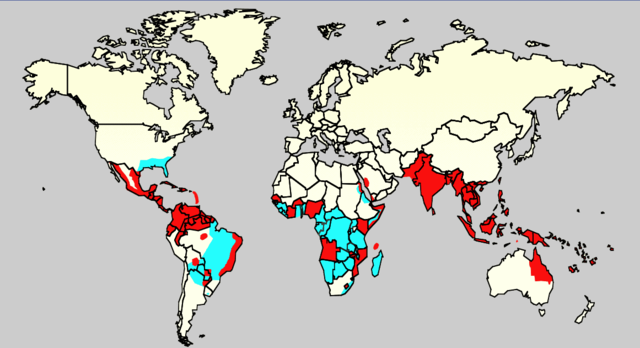
| 16:26, 18 Rhagfyr 2015 |  | 1,161 × 631 (63 KB) | Splette | Remove border between East and West Germany, as it has been united since 1990 (long before 2006) | |
| 23:34, 2 Mehefin 2007 |  | 1,161 × 631 (48 KB) | Aetheling | Map showing the distribution of dengue fever in the world, as of 2006. Map produced by the Agricultural Research Service of the US Department of Agriculture. Source: Slide #8 of a presentation by Gary G. Clark, PhD, entitled "Dengue: An emerging arbovira |
Cysylltiadau'r ffeil
Mae'r 1 tudalennau a ddefnyddir isod yn cysylltu i'r ddelwedd hon:
Defnydd cydwici y ffeil
Mae'r wicis eraill hyn yn defnyddio'r ffeil hon:
- Y defnydd ar ar.wikipedia.org
- Y defnydd ar arz.wikipedia.org
- Y defnydd ar ast.wikipedia.org
- Y defnydd ar bn.wikipedia.org
- Y defnydd ar ca.wikipedia.org
- Y defnydd ar cs.wikipedia.org
- Y defnydd ar de.wikipedia.org
- Y defnydd ar el.wikipedia.org
- Y defnydd ar en.wikipedia.org
- Natural hazards in Colombia
- Mosquito-borne disease
- User:Justthefacts1/Sandbox
- Dengue fever outbreaks
- Talk:Dengue fever/Archive 1
- Wikipedia:Wikipedia Signpost/2011-07-11/Featured content
- Wikipedia:WikiProject Medicine/Collaborative publication/Dengue fever
- Wikipedia:Wikipedia Signpost/2014-10-01/News and notes
- Wikipedia:Wikipedia Signpost/Single/2014-10-01
- Wikipedia:Wikipedia Signpost/Single/2011-07-11
- User:Notorious Biggles/Tobagoitis
- Wikipedia:WikiProject WikiFundi Content/Dengue fever
- Y defnydd ar es.wikipedia.org
- Y defnydd ar es.wiktionary.org
- Y defnydd ar eu.wikipedia.org
- Y defnydd ar fa.wikipedia.org
- Y defnydd ar fi.wikipedia.org
- Y defnydd ar fr.wikipedia.org
- Y defnydd ar ga.wikipedia.org
- Y defnydd ar he.wikipedia.org
- Y defnydd ar hi.wikipedia.org
- Y defnydd ar hr.wikipedia.org
- Y defnydd ar hu.wikipedia.org
- Y defnydd ar hu.wikibooks.org
- Y defnydd ar is.wikipedia.org
- Y defnydd ar it.wikipedia.org
- Y defnydd ar ja.wikipedia.org
- Y defnydd ar la.wikipedia.org
- Y defnydd ar ml.wikipedia.org
- Y defnydd ar ms.wikipedia.org
- Y defnydd ar nl.wikipedia.org
- Y defnydd ar no.wikipedia.org
- Y defnydd ar or.wikipedia.org
- Y defnydd ar pl.wikipedia.org
Gweld rhagor o'r defnydd cydwici o'r ffeil hon.