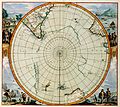
Delwedd:Detail of 1657 map Polus Antarcticus by Jan Janssonius, showing Nova Zeelandia.png
Detail_of_1657_map_Polus_Antarcticus_by_Jan_Janssonius,_showing_Nova_Zeelandia.png ((684 × 532 picsel, maint y ffeil: 508 KB, ffurf MIME: image/png))
Hanes y ffeil
Cliciwch ar ddyddiad / amser i weld y ffeil fel ag yr oedd bryd hynny.
| Dyddiad / Amser | Bawdlun | Hyd a lled | Defnyddiwr | Sylw | |
|---|---|---|---|---|---|
| cyfredol | 11:22, 25 Ionawr 2011 |  | 684 × 532 (508 KB) | Avenue | Higher resolution, stronger lines of latitude and longitude, different colours. |
| 13:14, 16 Ionawr 2010 |  | 229 × 183 (62 KB) | Avenue | {{Information |Description={{en|1=Detail of 1657 map ''Polus Antarcticus'' by Jan Janssonius, showing western coastline of New Zealand (labelled "Nova Zeelandia").}} |Source=1657 map ''Polus Antarcticus'' by Jan Janssonius (1588-1664). Copied from http:// |
Cysylltiadau'r ffeil
Mae'r 1 tudalennau a ddefnyddir isod yn cysylltu i'r ddelwedd hon:
Defnydd cydwici y ffeil
Mae'r wicis eraill hyn yn defnyddio'r ffeil hon:
- Y defnydd ar af.wikipedia.org
- Y defnydd ar ar.wikipedia.org
- Y defnydd ar bn.wikipedia.org
- Y defnydd ar cbk-zam.wikipedia.org
- Y defnydd ar cs.wikipedia.org
- Y defnydd ar en.wikipedia.org
- Y defnydd ar es.wikipedia.org
- Y defnydd ar gl.wikipedia.org
- Y defnydd ar id.wikipedia.org
- Y defnydd ar incubator.wikimedia.org
- Y defnydd ar io.wikipedia.org
- Y defnydd ar is.wikipedia.org
- Y defnydd ar ka.wikipedia.org
- Y defnydd ar ko.wikipedia.org
- Y defnydd ar mk.wikipedia.org
- Y defnydd ar nl.wikipedia.org
- Y defnydd ar nn.wikipedia.org
- Y defnydd ar pa.wikipedia.org
- Y defnydd ar pt.wikipedia.org
- Y defnydd ar ru.wikipedia.org
- Y defnydd ar sh.wikipedia.org
- Y defnydd ar sl.wikipedia.org
- Y defnydd ar sr.wikipedia.org
- Y defnydd ar ta.wikipedia.org
- Y defnydd ar tr.wikipedia.org
- Y defnydd ar uz.wikipedia.org
- Y defnydd ar vi.wikipedia.org


