Delwedd:Halghton Hall.png
Maint llawn ((782 × 821 picsel, maint y ffeil: 1.15 MB, ffurf MIME: image/png))
Crynodeb
| Disgrifiad |
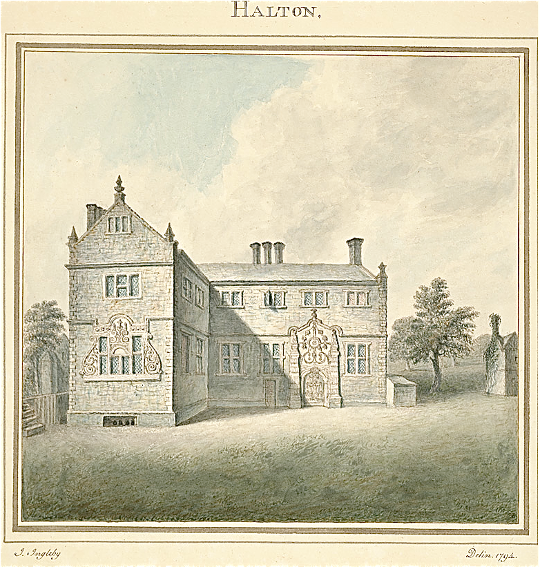
English: Halghton Hall, Hanmer, Wrexham. 1794 |
| Dyddiad | |
| Ffynhonnell | http://www.llgc.org.uk/digitalmirror/ |
| Awdur | John Inglbey, artist 1794 |
| Camera location | | View this and other nearby images on: OpenStreetMap |
|---|
Brick house with stone dressings.The present house is said to have been built in 1662, probably by a member of the Hanmer family. It was probably intended to have an H-plan, which would have required building an additional bay on the right hand side side of the main range and another cross wing, to make a symmetrical elevation. Hubbard, Edward, The Buildings of Wales: Clwyd, 1986, p 358’’; Smith, Peter, Houses of the Welsh Countryside, 2nd ed 1988, map 54
Trwyddedu
 |
Ffynhonnell y ffeil hon yw http://www.llgc.org.uk/cy/. Rheolir y wefan gan Lyfrgell Genedlaethol Cymru. |
|
This work is in the public domain in its country of origin and other countries and areas where the copyright term is the author's life plus 100 years or fewer. | |
| Canfyddwyd bod y ffeil yn rhydd o gyfyngiadau yn ôl cyfraith hawlfraint, gan gynnwys pob hawl perthynol a chyfagos. | |
Hanes y ffeil
Cliciwch ar ddyddiad / amser i weld y ffeil fel ag yr oedd bryd hynny.
| Dyddiad / Amser | Bawdlun | Hyd a lled | Defnyddiwr | Sylw | |
|---|---|---|---|---|---|
| cyfredol | 21:54, 9 Chwefror 2015 | | 782 × 821 (1.15 MB) | Tyssil | User created page with UploadWizard |
Cysylltiadau'r ffeil
Mae'r 1 tudalennau a ddefnyddir isod yn cysylltu i'r ddelwedd hon:
Defnydd cydwici y ffeil
Mae'r wicis eraill hyn yn defnyddio'r ffeil hon:
- Y defnydd ar en.wikipedia.org
- Y defnydd ar www.wikidata.org