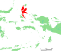
Delwedd:ID Halmahera.PNG
ID_Halmahera.PNG ((670 × 561 picsel, maint y ffeil: 20 KB, ffurf MIME: image/png))
Hanes y ffeil
Cliciwch ar ddyddiad / amser i weld y ffeil fel ag yr oedd bryd hynny.
| Dyddiad / Amser | Bawdlun | Hyd a lled | Defnyddiwr | Sylw | |
|---|---|---|---|---|---|
| cyfredol | 09:21, 26 Medi 2007 |  | 670 × 561 (20 KB) | Michiel1972 | |
| 23:43, 15 Gorffennaf 2006 |  | 670 × 561 (20 KB) | Michiel1972 | {{Information |Description= {{subst:PAGENAME}} |Source= own work based on PD map |Date= |Author= edited by M.Minderhoud |Permission= {{PD-Demis}} |other_versions= }} category:Locator maps of islands in Indonesia |
Cysylltiadau'r ffeil
Mae'r 1 tudalennau a ddefnyddir isod yn cysylltu i'r ddelwedd hon:
Defnydd cydwici y ffeil
Mae'r wicis eraill hyn yn defnyddio'r ffeil hon:
- Y defnydd ar ar.wikipedia.org
- Y defnydd ar br.wikipedia.org
- Y defnydd ar cs.wikipedia.org
- Y defnydd ar de.wikipedia.org
- Y defnydd ar el.wikipedia.org
- Y defnydd ar et.wikipedia.org
- Y defnydd ar it.wikipedia.org
- Y defnydd ar ja.wikipedia.org
- Y defnydd ar ko.wikipedia.org
- Y defnydd ar mrj.wikipedia.org
- Y defnydd ar nl.wikipedia.org
- Y defnydd ar tr.wikipedia.org
- Y defnydd ar war.wikipedia.org
