Maint llawn((5,010 × 3,838 picsel, maint y ffeil: 8.25 MB, ffurf MIME: image/jpeg))

Daw'r ffeil hon o Comin Wikimedia a gellir ei defnyddio gan brosiectau eraill. Dangosir isod y disgrifiad sydd ar dudalen ddisgrifio'r ffeil yno.

Crynodeb

John Speed: Map o Cymru gan John Speed  wikidata:Q22912348 reasonator:Q22912348
Arlunydd
John Speed  (–1629)  wikidata:Q1245028 s:en:Author:John Speed
 
John Speed
Disgrifiad Prydeinig mapiwr a/ac hanesydd
Dyddiad geni/marw circa 1552
date QS:P,+1552-00-00T00:00:00Z/9,P1480,Q5727902
29 Gorffennaf 1629
Man geni/marw Farndon Llundain
Rheolaeth awdurdod
artist QS:P170,Q1245028
image of artwork listed in title parameter on this page
Teitl
John Speed's map of Wales, 1610
Cyhoeddwr
Object type map / print Golygu ar Wicidata
Disgrifiad
Français : Carte du Pays de Galles, par John Speed, 1610.
Cymraeg: Map o Cymru gan John Speed, 1610
English: Map of Wales by John Speed, 1610.
Shows Welsh counties and parts of adjoining English counties, including much of Herefordshire and Shropshire. Identifies towns, larger villages parish churches, rivers and diagramatic representation of higher hills and mountains. Compass rose in Irish Sea bearing the Arms of the Princes of Wales at its centre, the sea shaded to resemble watered silk in the style of Hondius.
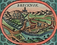
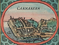
The sides of the maps are flanked by twelve views of the County Towns of Wales with smaller insets of the four Cathedral Cities of Bangor, St Asaph, Llandaff and St. David's set into each of the map's corners.
Text verso printed upside down on pages 99 and 100 of "The generall description, and severall divisions of the Principality of Wales." Sign Ggg....sold by John Sudbury and George Humble in Popes head allye - cum privilegio. 1610.
Dyddiad 1610
date QS:P571,+1610-00-00T00:00:00Z/9
Hyd a lled 360 × 330 mm
institution QS:P195,Q666063
Man cyhoeddi Llundain Golygu ar Wicidata
Nodiadau Scale (1:576.000)
Rheolaeth awdurdod
Ffynhonnell/Ffotograffydd
This image is available from the National Library of Wales
You can view this image in its original context on the NLW Catalogue
Caniatâd
(Ailddefnyddio'r ffeil hon)
Public domain

This work is in the public domain in its country of origin and other countries and areas where the copyright term is the author's life plus 100 years or fewer.


This work is in the public domain in the United States because it was published (or registered with the U.S. Copyright Office) before January 1, 1929.

Diwygiadau eraill Cropped Inserts of principal towns:

VI seal

This image has been assessed under the valued image criteria and is considered the most valued image on Commons within the scope: Map of Wales by John Speed. You can see its nomination here.

Captions

Add a one-line explanation of what this file represents

Hanes y ffeil

Cliciwch ar ddyddiad / amser i weld y ffeil fel ag yr oedd bryd hynny.

Dyddiad / AmserBawdlunHyd a lledDefnyddiwrSylw
cyfredol13:01, 21 Hydref 2015Bawdlun y fersiwn am 13:01, 21 Hydref 20155,010 × 3,838 (8.25 MB)Jason.nlwUser created page with UploadWizard

Mae'r 2 tudalennau a ddefnyddir isod yn cysylltu i'r ddelwedd hon:

Defnydd cydwici y ffeil

Mae'r wicis eraill hyn yn defnyddio'r ffeil hon:

Metadata