Delwedd:Judge Nathan Roberts House, State Highway 5, Canastota vicinity (Madison County, New York).jpg
Wedi ei chwyddo hyd yr eithaf.
Judge_Nathan_Roberts_House,_State_Highway_5,_Canastota_vicinity_(Madison_County,_New_York).jpg ((553 × 323 picsel, maint y ffeil: 97 KB, ffurf MIME: image/jpeg))
|
This is an image of a place or building that is listed on the National Register of Historic Places in the United States of America. Its reference number is 86001305. |
| Disgrifiad |
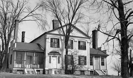
English: Judge Nathan Roberts House, State Highway 5, Canastota vicinity (Madison County, New York)
cropped |
|||||
| Dyddiad | ||||||
| Ffynhonnell | http://memory.loc.gov/cgi-bin/displayPhoto.pl?path=/pnp/habshaer/ny/ny0200/ny0262/photos&topImages=117115pr.jpg&topLinks=117115pv.jpg,117115pu.tif&title=1.%20%20Historic%20American%20Buildings%20Survey,%20M.E.%20Granger,%20Photographer%20Mar.%2028,%201934,%20VIEW%20FROM%20SOUTH%20(FRONT).%3cbr%3eHABS%20NY,27-CANA.V,1-1&displayProfile=0 | |||||
| Awdur | M.E. Granger, Photographer | |||||
| Caniatâd (Ailddefnyddio'r ffeil hon) |
|

.jpg)
.%3cbr%3eHABS%20NY,27-CANA.V,1-1&displayProfile=0)
| Object location | | View this and other nearby images on: OpenStreetMap |
|---|
.jpg¶ms=043.068333_N_-075.758889_E_globe:Earth_class:object_region:US_type:landmark_scale:1500_&language=cy)
Hanes y ffeil
Cliciwch ar ddyddiad / amser i weld y ffeil fel ag yr oedd bryd hynny.
| Dyddiad / Amser | Bawdlun | Hyd a lled | Defnyddiwr | Sylw | |
|---|---|---|---|---|---|
| cyfredol | 17:25, 2 Awst 2009 | | 553 × 323 (97 KB) | KudzuVine | {{Information |Description={{en|1=Judge Nathan Roberts House, State Highway 5, Canastota vicinity (Madison County, New York) cropped {{PD-USGov-Interior-HABS|NY,27-CANA.V,1-1}}}} |Source=http://memory.loc.gov/cgi-bin/displayPhoto.pl?path=/pnp/habshaer/ny/ |
Cysylltiadau'r ffeil
Mae'r 1 tudalennau a ddefnyddir isod yn cysylltu i'r ddelwedd hon:
Defnydd cydwici y ffeil
Mae'r wicis eraill hyn yn defnyddio'r ffeil hon:
- Y defnydd ar ar.wikipedia.org
- Y defnydd ar ca.wikipedia.org
- Y defnydd ar ceb.wikipedia.org
- Y defnydd ar en.wikipedia.org
- Y defnydd ar es.wikipedia.org
- Y defnydd ar eu.wikipedia.org
- Y defnydd ar fr.wikipedia.org
- Y defnydd ar ht.wikipedia.org
- Y defnydd ar it.wikipedia.org
- Y defnydd ar lld.wikipedia.org
- Y defnydd ar pl.wikipedia.org
- Y defnydd ar ru.wikipedia.org
- Y defnydd ar sh.wikipedia.org
- Y defnydd ar sr.wikipedia.org
- Y defnydd ar uk.wikipedia.org
- Y defnydd ar www.wikidata.org
.jpg)