Delwedd:Kotelnyy Bunge Faddeyevsky MODIS.jpg

Maint y rhagolwg: 800 × 549 picsel. Eglurdebau eraill: 320 × 219 picsel | 640 × 439 picsel | 1,024 × 702 picsel | 1,200 × 823 picsel.
Maint llawn ((1,200 × 823 picsel, maint y ffeil: 259 KB, ffurf MIME: image/jpeg))
Crynodeb
| Disgrifiad |
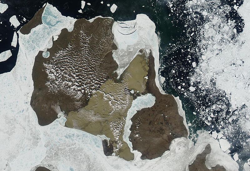
English: Aqua MODIS satellite image of Kotelnyy and Faddeyevsky Island, New Siberian Islands, Russia, connected by sandy Bunge Land |
| Dyddiad | |
| Ffynhonnell | http://www.oceandots.com/arctic/new-siberian/kotelnyy.php |
| Awdur | satellite image created by the MODIS Rapid Response System, NASA/GSFC |
| Diwygiadau eraill |

Trwyddedu
| This file is in the public domain in the United States because it was solely created by NASA. NASA copyright policy states that "NASA material is not protected by copyright unless noted". (See Template:PD-USGov, NASA copyright policy page or JPL Image Use Policy.) | ||
 |
Warnings:
|
Hanes y ffeil
Cliciwch ar ddyddiad / amser i weld y ffeil fel ag yr oedd bryd hynny.
| Dyddiad / Amser | Bawdlun | Hyd a lled | Defnyddiwr | Sylw | |
|---|---|---|---|---|---|
| cyfredol | 11:56, 11 Mawrth 2010 | | 1,200 × 823 (259 KB) | Telim tor | == {{int:filedesc}} == {{Information |Description={{en|NASA MODIS satellite image of Kotelnyy and Faddeyevsky Island, New Siberian Islands, Russia, connected by sandy Bunge Land}} |Source=http://www.oceandots.com/arctic/new-siberian/kotelnyy.php |Date=not |
Cysylltiadau'r ffeil
Mae'r 1 tudalennau a ddefnyddir isod yn cysylltu i'r ddelwedd hon:
Defnydd cydwici y ffeil
Mae'r wicis eraill hyn yn defnyddio'r ffeil hon:
- Y defnydd ar ar.wikipedia.org
- Y defnydd ar arz.wikipedia.org
- Y defnydd ar az.wikipedia.org
- Y defnydd ar be.wikipedia.org
- Y defnydd ar bg.wikipedia.org
- Y defnydd ar ca.wikipedia.org
- Y defnydd ar ceb.wikipedia.org
- Y defnydd ar cs.wikipedia.org
- Y defnydd ar de.wikipedia.org
- Y defnydd ar eo.wikipedia.org
- Y defnydd ar fi.wikipedia.org
- Y defnydd ar hy.wikipedia.org
- Y defnydd ar lv.wikipedia.org
- Y defnydd ar nn.wikipedia.org
- Y defnydd ar no.wikipedia.org
- Y defnydd ar pl.wikipedia.org
- Y defnydd ar pt.wikipedia.org
- Y defnydd ar ru.wikipedia.org
- Y defnydd ar sl.wikipedia.org
- Y defnydd ar tt.wikipedia.org
- Y defnydd ar uk.wikipedia.org
- Y defnydd ar www.wikidata.org