Delwedd:Saratoga Springs Saratoga NY.png

Maint y rhagolwg: 573 × 600 picsel. Eglurdebau eraill: 229 × 240 picsel | 459 × 480 picsel | 778 × 814 picsel.
Maint llawn ((778 × 814 picsel, maint y ffeil: 32 KB, ffurf MIME: image/png))

|
This locator map image could be re-created using vector graphics as an SVG file. This has several advantages; see Commons:Media for cleanup for more information. If an SVG form of this image is available, please upload it and afterwards replace this template with
{{vector version available|new image name}}.
It is recommended to name the SVG file “Saratoga Springs Saratoga NY.svg”—then the template Vector version available (or Vva) does not need the new image name parameter. |
Crynodeb
| Disgrifiad |
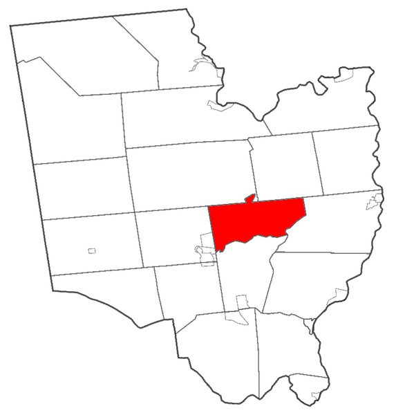
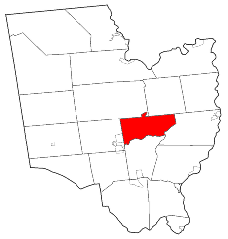
English: Map of Saratoga County highlighting Saratoga Springs |
| Dyddiad | |
| Ffynhonnell | Own work by uploader; made using Census 2000 data from [1] |
| Awdur | Schzmo |
Trwyddedu
| Yr wyf fi, deiliad hawlfraint y gwaith hwn, yn ei ryddhau i'r parth cyhoeddus, a hynny'n fyd-eang. Hwyrach nad yw hyn yn bosib yn ôl cyfraith rhai gwledydd; os felly: Rwyn rhoi i unrhywun yr hawl i ddefnyddio'r gwaith hwn at unrhyw ddiben, heb unrhyw amodau, oddieithr unrhyw amodau gofynnol yn ôl y gyfraith. |
Hanes y ffeil
Cliciwch ar ddyddiad / amser i weld y ffeil fel ag yr oedd bryd hynny.
| Dyddiad / Amser | Bawdlun | Hyd a lled | Defnyddiwr | Sylw | |
|---|---|---|---|---|---|
| cyfredol | 20:29, 10 Mawrth 2009 | | 778 × 814 (32 KB) | Schzmo | {{Information |Description={{en|1=Map of Saratoga County highlighting Saratoga Springs}} |Source=Own work by uploader; made using Census 2000 data from [http://www.census.gov/geo/www/cob/index.html] |Author=Schzmo |Date=2009-03-10 |Permiss |
Cysylltiadau'r ffeil
Mae'r 1 tudalennau a ddefnyddir isod yn cysylltu i'r ddelwedd hon:
Defnydd cydwici y ffeil
Mae'r wicis eraill hyn yn defnyddio'r ffeil hon:
- Y defnydd ar ar.wikipedia.org
- Y defnydd ar azb.wikipedia.org
- Y defnydd ar ca.wikipedia.org
- Y defnydd ar ceb.wikipedia.org
- Y defnydd ar en.wikipedia.org
- Y defnydd ar eu.wikipedia.org
- Y defnydd ar fa.wikipedia.org
- Y defnydd ar fr.wikipedia.org
- Y defnydd ar ht.wikipedia.org
- Y defnydd ar hu.wikipedia.org
- Y defnydd ar id.wikipedia.org
- Y defnydd ar it.wikipedia.org
- Y defnydd ar ja.wikipedia.org
- Y defnydd ar ml.wikipedia.org
- Y defnydd ar pl.wikipedia.org
- Y defnydd ar pl.wikivoyage.org
- Y defnydd ar ro.wikipedia.org
- Y defnydd ar simple.wikipedia.org
- Y defnydd ar sr.wikipedia.org
- Y defnydd ar tr.wikipedia.org
- Y defnydd ar tt.wikipedia.org
- Y defnydd ar vo.wikipedia.org
- Y defnydd ar www.wikidata.org
- Y defnydd ar zh-min-nan.wikipedia.org
- Y defnydd ar zh.wikipedia.org