Delwedd:Top Of Kilkerran Castle - geograph.org.uk - 1208069.jpg
Wedi ei chwyddo hyd yr eithaf.
Top_Of_Kilkerran_Castle_-_geograph.org.uk_-_1208069.jpg ((640 × 426 picsel, maint y ffeil: 124 KB, ffurf MIME: image/jpeg))
Crynodeb
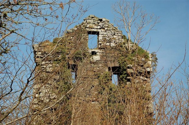
| Disgrifiad |
English: Top Of Kilkerran Castle The windows of the third floor bedrooms and the attic room that was in the battlements of the Fergusson family's early 16th century castle. (Source: "The Castles Of South-West Scotland", by Mike Salter). |
| Dyddiad | |
| Ffynhonnell | From geograph.org.uk |
| Awdur | Mary and Angus Hogg |
| Cydnabyddiaeth (required by the license) | Mary and Angus Hogg / Top Of Kilkerran Castle / |
| Camera location | | View this and other nearby images on: OpenStreetMap |
|---|
_heading:337.00&language=cy)
| Object location | | View this and other nearby images on: OpenStreetMap |
|---|
_heading:337.00&language=cy)
Trwyddedu

|
This image was taken from the Geograph project collection. See this photograph's page on the Geograph website for the photographer's contact details. The copyright on this image is owned by Mary and Angus Hogg and is licensed for reuse under the Creative Commons Attribution-ShareAlike 2.0 license.
|
Trwyddedir y ffeil hon yn ôl termau'r drwydded Creative Commons Attribution-Share Alike 2.0 Generic.
Cydnabyddiaeth: Mary and Angus Hogg
- Mae'n rhydd i chi:
- rhannu – gallwch gopïo, dosbarthu a throsglwyddo'r gwaith
- ailwampio – gallwch addasu'r gwaith
- Ar yr amodau canlynol:
- cydnabyddiaeth – Mae'n rhaid i chi nodi manylion y gwaith hwn, rhoi dolen i'r drwydded, a nodi os y bu golygu arni, yn y modd a benwyd gan yr awdur neu'r trwyddedwr (ond heb awgrymu o gwbl eu bod yn eich cymeradwyo chi na'ch defnydd o'r gwaith).
- rhannu ar dermau tebyg – Os byddwch yn addasu'r gwaith hwn, neu yn ei drawsnewid, neu yn adeiladu arno, mae'n rhaid i chi ddosbarthu'r gwaith dan drwydded sy'n union yr un fath same a'r gwreiddiol.

|
The categories of this image need checking. You can do so here.
|
Hanes y ffeil
Cliciwch ar ddyddiad / amser i weld y ffeil fel ag yr oedd bryd hynny.
| Dyddiad / Amser | Bawdlun | Hyd a lled | Defnyddiwr | Sylw | |
|---|---|---|---|---|---|
| cyfredol | 04:50, 26 Chwefror 2011 | | 640 × 426 (124 KB) | GeographBot | == {{int:filedesc}} == {{Information |description={{en|1=Top Of Kilkerran Castle The windows of the third floor bedrooms and the attic room that was in the battlements of the Fergusson family's early 16th century castle. (Source: "The Castles Of South-We |
Cysylltiadau'r ffeil
Nid oes tudalennau'n defnyddio'r ffeil hon.
Defnydd cydwici y ffeil
Mae'r wicis eraill hyn yn defnyddio'r ffeil hon:
- Y defnydd ar de.wikipedia.org
- Y defnydd ar en.wikipedia.org
- Y defnydd ar pt.wikipedia.org
- Y defnydd ar www.wikidata.org