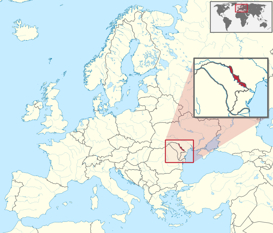
Delwedd:Transnistria in Europe (zoomed).svg

Maint rhagolwg PNG o ffeil SVG yw: 701 × 599 picsel. Eglurdebau eraill: 281 × 240 picsel | 561 × 480 picsel | 898 × 768 picsel | 1,198 × 1,024 picsel | 2,395 × 2,048 picsel | 1,401 × 1,198 picsel.
Maint llawn (Ffeil SVG, maint mewn enw 1,401 × 1,198 picsel, maint y ffeil: 2.67 MB)
Crynodeb

|
This file requires updating because: Artsakh needs removing In doing so, you could add a timestamp to the file.
|
.svg)
.svg)
.svg)
.svg)
.svg)
.svg)
.svg)

-en.svg)

.svg)
.svg)
.svg)

_(US48).svg)
_(small_islands_magnified)_(-mini_map_-rivers).svg)
.svg)
_(extra_close)_(US48).svg)
.svg)
_(zoom).svg)

.svg)


_(UNMIK).svg)
.svg)
_(disputed_hatched).svg)
_(claimed_and_disputed_hatched).svg)
.svg)
.svg)
_(%2Ball_claims_hatched).svg)

.svg)
_(shade).svg)
_(shade)_(special_marker).svg)
_(-mini_map).svg)
_(-mini_map).svg)
_(-mini_map).svg)


.svg)

.svg)
.svg)
Trwyddedu
Yr wyf fi, deiliad yr hawlfraint ar y gwaith hwn, yn ei gyhoeddi yn ôl termau'r drwydded a ganlyn:
Trwyddedir y ffeil hon yn ôl termau'r drwydded Creative Commons Attribution-Share Alike 3.0 Unported.
- Mae'n rhydd i chi:
- rhannu – gallwch gopïo, dosbarthu a throsglwyddo'r gwaith
- ailwampio – gallwch addasu'r gwaith
- Ar yr amodau canlynol:
- cydnabyddiaeth – Mae'n rhaid i chi nodi manylion y gwaith hwn, rhoi dolen i'r drwydded, a nodi os y bu golygu arni, yn y modd a benwyd gan yr awdur neu'r trwyddedwr (ond heb awgrymu o gwbl eu bod yn eich cymeradwyo chi na'ch defnydd o'r gwaith).
- rhannu ar dermau tebyg – Os byddwch yn addasu'r gwaith hwn, neu yn ei drawsnewid, neu yn adeiladu arno, mae'n rhaid i chi ddosbarthu'r gwaith dan drwydded sy'n union yr un fath same a'r gwreiddiol.

|
I'd greatly appreciate, that you attribute this media file to Wikimedia Commons, if used outside Wikipedia or Commons. For use in publications such as books, newspapers, blogs, websites, please insert here the following line:
|
.svg)
Hanes y ffeil
Cliciwch ar ddyddiad / amser i weld y ffeil fel ag yr oedd bryd hynny.
| Dyddiad / Amser | Bawdlun | Hyd a lled | Defnyddiwr | Sylw | |
|---|---|---|---|---|---|
| cyfredol | 09:39, 25 Awst 2014 | | 1,401 × 1,198 (2.67 MB) | Nicolay Sidorov | fix border (+Bendery) |
| 09:39, 9 Awst 2011 |  | 1,401 × 1,198 (4.07 MB) | TUBS | {{Information |Description={{de|Lage von XY (siehe Dateiname) in Europa.}} {{en|Location of XY (see filename) in Europe.}} |Source={{own}}{{Adobe Illustrator}}{{Commonist}}{{AttribSVG|Europe laea location map.svg|Alexrk2}}{{ |
Cysylltiadau'r ffeil
Mae'r 1 tudalennau a ddefnyddir isod yn cysylltu i'r ddelwedd hon:
Defnydd cydwici y ffeil
Mae'r wicis eraill hyn yn defnyddio'r ffeil hon:
- Y defnydd ar als.wikipedia.org
- Y defnydd ar arz.wikipedia.org
- Y defnydd ar ast.wikipedia.org
- Y defnydd ar az.wikipedia.org
- Y defnydd ar ba.wikipedia.org
- Y defnydd ar bcl.wikipedia.org
- Y defnydd ar be.wikipedia.org
- Y defnydd ar bn.wikipedia.org
- Y defnydd ar ca.wikipedia.org
- Y defnydd ar cdo.wikipedia.org
- Y defnydd ar ce.wikipedia.org
- Y defnydd ar cs.wikipedia.org
- Y defnydd ar de.wikipedia.org
- Y defnydd ar diq.wikipedia.org
- Y defnydd ar el.wikipedia.org
- Y defnydd ar en.wikipedia.org
- Y defnydd ar en.wikivoyage.org
- Y defnydd ar es.wikipedia.org
- Y defnydd ar et.wikipedia.org
- Y defnydd ar fi.wikipedia.org
- Y defnydd ar gl.wikipedia.org
- Y defnydd ar hak.wikipedia.org
- Y defnydd ar he.wikipedia.org
- Y defnydd ar hi.wikipedia.org
- Y defnydd ar hsb.wikipedia.org
- Y defnydd ar ht.wikipedia.org
- Y defnydd ar hu.wikipedia.org
- Y defnydd ar hy.wikipedia.org
- Y defnydd ar id.wikipedia.org
- Y defnydd ar incubator.wikimedia.org
- Y defnydd ar is.wikipedia.org
- Y defnydd ar it.wikipedia.org
- Y defnydd ar it.wikivoyage.org
- Y defnydd ar ja.wikipedia.org
- Y defnydd ar kk.wikipedia.org
- Y defnydd ar km.wikipedia.org
- Y defnydd ar ko.wikipedia.org
Gweld rhagor o'r defnydd cydwici o'r ffeil hon.
.svg)
.svg)