Delwedd:Vermont (1).png
Wedi ei chwyddo hyd yr eithaf.
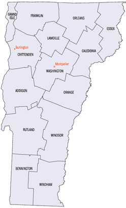
Vermont_(1).png ((248 × 408 picsel, maint y ffeil: 33 KB, ffurf MIME: image/png))
.png)

|
This map image could be re-created using vector graphics as an SVG file. This has several advantages; see Commons:Media for cleanup for more information. If an SVG form of this image is available, please upload it and afterwards replace this template with
{{vector version available|new image name}}.
It is recommended to name the SVG file “Vermont (1).svg”—then the template Vector version available (or Vva) does not need the new image name parameter. |
Crynodeb
| Disgrifiad |
English: Smaller version of Vermont county map (from PD image) |
| Ffynhonnell | Transferred from en.wikipedia to Commons by Sfan00_IMG using CommonsHelper. |
| Awdur |
Trwyddedu
This work is in the public domain in the United States because it is a work prepared by an officer or employee of the United States Government as part of that person’s official duties under the terms of Title 17, Chapter 1, Section 105 of the US Code.
Note: This only applies to original works of the Federal Government and not to the work of any individual U.S. state, territory, commonwealth, county, municipality, or any other subdivision. This template also does not apply to postage stamp designs published by the United States Postal Service since 1978. (See § 313.6(C)(1) of Compendium of U.S. Copyright Office Practices). It also does not apply to certain US coins; see The US Mint Terms of Use.
|
 | |
| Canfyddwyd bod y ffeil yn rhydd o gyfyngiadau yn ôl cyfraith hawlfraint, gan gynnwys pob hawl perthynol a chyfagos. | ||
Cofnod lòg yr uwchlwythiad gwreiddiol
The original description page was here. All following user names refer to en.wikipedia.
- 2007-10-29 01:02 Xskillz123x 248×408× (33626 bytes) Reverted to version as of 17:18, 24 March 2006
- 2006-07-02 14:48 Mickmaguire 248×408× (16952 bytes)
- 2006-03-24 17:18 Solarcaine 248×408× (33626 bytes)
- 2003-01-12 05:49 Dachshund 248×408× (46956 bytes) Smaller version of Vermont county map (from PD image)
Hanes y ffeil
Cliciwch ar ddyddiad / amser i weld y ffeil fel ag yr oedd bryd hynny.
| Dyddiad / Amser | Bawdlun | Hyd a lled | Defnyddiwr | Sylw | |
|---|---|---|---|---|---|
| cyfredol | 21:13, 20 Ionawr 2009 | | 248 × 408 (33 KB) | File Upload Bot (Magnus Manske) | {{BotMoveToCommons|en.wikipedia}} {{Information |Description={{en|Smaller version of Vermont county map (from PD image) en:Category:Vermont maps}} |Source=Transferred from [http://en.wikipedia.org en.wikipedia]; transferred to Commons by [[User:S |
Cysylltiadau'r ffeil
Mae'r 1 tudalennau a ddefnyddir isod yn cysylltu i'r ddelwedd hon:
Defnydd cydwici y ffeil
Mae'r wicis eraill hyn yn defnyddio'r ffeil hon:
- Y defnydd ar af.wikipedia.org
- Y defnydd ar ang.wikipedia.org
- Y defnydd ar ast.wikipedia.org
- Y defnydd ar en.wikipedia.org
- Y defnydd ar eo.wikipedia.org
- Y defnydd ar fr.wikipedia.org
- Y defnydd ar gu.wikipedia.org
- Y defnydd ar he.wikipedia.org
- Y defnydd ar hu.wikipedia.org
- Y defnydd ar ja.wikipedia.org
- Y defnydd ar pt.wikipedia.org
- Y defnydd ar sv.wikipedia.org
- Y defnydd ar tr.wikipedia.org
- Y defnydd ar vi.wikipedia.org
- Y defnydd ar www.wikidata.org
.png)