Delwedd:Wetlands Cape May New Jersey.jpg
Maint y rhagolwg: 800 × 529 picsel. Eglurdebau eraill: 320 × 212 picsel | 640 × 423 picsel | 1,024 × 677 picsel | 1,500 × 992 picsel.
Maint llawn ((1,500 × 992 picsel, maint y ffeil: 737 KB, ffurf MIME: image/jpeg))
| Disgrifiad |
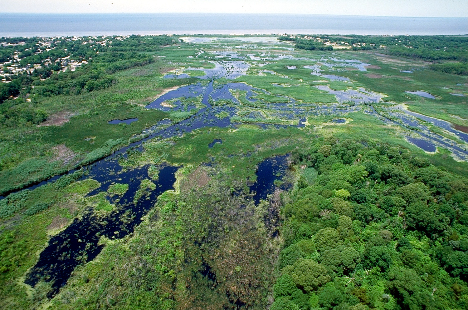
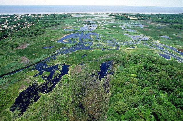
English: Wetlands in Cape May, New Jersey, USA.
View of Fishing Creek Marsh with Miami Beach, New Jersey on the left. A managed by Cape May County Park system. [1] |
|||
| Dyddiad | not specified or unknown | |||
| Ffynhonnell |
U.S. Army Corps of Engineers Digital Visual Library Image page Image description page Digital Visual Library home page |
|||
| Awdur | Anthony Bley, U.S. Army Corps of Engineers | |||
| Caniatâd (Ailddefnyddio'r ffeil hon) |
|
|||
| Lleoliad | Cape May, New Jersey, USA |
| Camera location | | View this and other nearby images on: OpenStreetMap |
|---|
Hanes y ffeil
Cliciwch ar ddyddiad / amser i weld y ffeil fel ag yr oedd bryd hynny.
| Dyddiad / Amser | Bawdlun | Hyd a lled | Defnyddiwr | Sylw | |
|---|---|---|---|---|---|
| cyfredol | 01:59, 8 Ebrill 2007 | | 1,500 × 992 (737 KB) | DanMS | {{Information | Description = {{en|Wetlands on Cape May, New Jersey, USA.}} | Source = U.S. Army Corps of Engineers Digital Visual Library<br />[http://images.usace.army.mil/images/Hires/4171-10.Jpg Image page]<br />[http://images.usace.army.mi |
Cysylltiadau'r ffeil
Mae'r 1 tudalennau a ddefnyddir isod yn cysylltu i'r ddelwedd hon:
Defnydd cydwici y ffeil
Mae'r wicis eraill hyn yn defnyddio'r ffeil hon:
- Y defnydd ar ca.wikipedia.org
- Y defnydd ar en.wikipedia.org
- Y defnydd ar es.wikipedia.org
- Y defnydd ar fr.wikipedia.org
- Y defnydd ar fr.wikiversity.org
- Y defnydd ar he.wikipedia.org
- Y defnydd ar pl.wikipedia.org
- Y defnydd ar ro.wikipedia.org
- Y defnydd ar www.wikidata.org