Delwedd:Thames Estuary and Wind Farms from Space NASA.jpg

Maint y rhagolwg: 750 × 600 picsel. Eglurdebau eraill: 300 × 240 picsel | 600 × 480 picsel | 960 × 768 picsel | 1,280 × 1,024 picsel | 2,560 × 2,048 picsel | 5,000 × 4,000 picsel.
Maint llawn ((5,000 × 4,000 picsel, maint y ffeil: 2.34 MB, ffurf MIME: image/jpeg))
Crynodeb
| Disgrifiad |
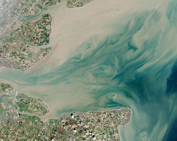
English: Thames Estuary and Wind Farms from Space NASA. Windfarms visible in the image are: London Array, Thanet Wind Farm, Kentish Flats Wind Farm and Gunfleet Sands Wind Farm. |
| Dyddiad | |
| Ffynhonnell | http://earthobservatory.nasa.gov/IOTD/view.php?id=82844 |
| Awdur | Operational Land Imager |
| Diwygiadau eraill |
 (with annotations) |
| Camera location | | View this and other nearby images on: OpenStreetMap |
|---|
Trwyddedu
| This file is in the public domain in the United States because it was solely created by NASA. NASA copyright policy states that "NASA material is not protected by copyright unless noted". (See Template:PD-USGov, NASA copyright policy page or JPL Image Use Policy.) | ||
 |
Warnings:
|
Hanes y ffeil
Cliciwch ar ddyddiad / amser i weld y ffeil fel ag yr oedd bryd hynny.
| Dyddiad / Amser | Bawdlun | Hyd a lled | Defnyddiwr | Sylw | |
|---|---|---|---|---|---|
| cyfredol | 21:10, 22 Mehefin 2015 | | 5,000 × 4,000 (2.34 MB) | Delusion23 | User created page with UploadWizard |
Cysylltiadau'r ffeil
Mae'r 1 tudalennau a ddefnyddir isod yn cysylltu i'r ddelwedd hon:
Defnydd cydwici y ffeil
Mae'r wicis eraill hyn yn defnyddio'r ffeil hon:
- Y defnydd ar ceb.wikipedia.org
- Y defnydd ar en.wikipedia.org
- Y defnydd ar en.wikibooks.org
- Y defnydd ar es.wikipedia.org
- Y defnydd ar eu.wikipedia.org
- Y defnydd ar fa.wikipedia.org
- Y defnydd ar ga.wikipedia.org
- Y defnydd ar it.wikipedia.org
- Y defnydd ar ko.wikipedia.org
- Y defnydd ar ne.wikipedia.org
- Y defnydd ar ru.wikipedia.org
- Y defnydd ar sl.wikipedia.org
- Y defnydd ar sv.wikipedia.org
- Y defnydd ar uk.wikipedia.org
- Y defnydd ar www.wikidata.org
- Y defnydd ar zh.wikipedia.org