Delwedd:Trebanog Village from Cymmer Mountain - geograph.org.uk - 1387248.jpg
Wedi ei chwyddo hyd yr eithaf.
Trebanog_Village_from_Cymmer_Mountain_-_geograph.org.uk_-_1387248.jpg ((640 × 428 picsel, maint y ffeil: 55 KB, ffurf MIME: image/jpeg))
Crynodeb
| Disgrifiad |
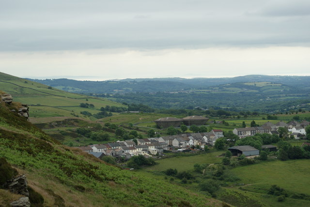
English: Trebanog Village from Cymmer Mountain A great view from the top of Cymmer Mountain , the Bristol Channel in the distance.
Those concrete things are not flying saucers behind the village but water tanks. |
| Dyddiad | |
| Ffynhonnell | From geograph.org.uk |
| Awdur | Rod John |
| Cydnabyddiaeth (required by the license) | Rod John / Trebanog Village from Cymmer Mountain / |
| Camera location | | View this and other nearby images on: OpenStreetMap |
|---|
_heading:157.00&language=cy)
| Object location | | View this and other nearby images on: OpenStreetMap |
|---|
_heading:157.00&language=cy)
Trwyddedu

|
This image was taken from the Geograph project collection. See this photograph's page on the Geograph website for the photographer's contact details. The copyright on this image is owned by Rod John and is licensed for reuse under the Creative Commons Attribution-ShareAlike 2.0 license.
|
Trwyddedir y ffeil hon yn ôl termau'r drwydded Creative Commons Attribution-Share Alike 2.0 Generic.
Cydnabyddiaeth: Rod John
- Mae'n rhydd i chi:
- rhannu – gallwch gopïo, dosbarthu a throsglwyddo'r gwaith
- ailwampio – gallwch addasu'r gwaith
- Ar yr amodau canlynol:
- cydnabyddiaeth – Mae'n rhaid i chi nodi manylion y gwaith hwn, rhoi dolen i'r drwydded, a nodi os y bu golygu arni, yn y modd a benwyd gan yr awdur neu'r trwyddedwr (ond heb awgrymu o gwbl eu bod yn eich cymeradwyo chi na'ch defnydd o'r gwaith).
- rhannu ar dermau tebyg – Os byddwch yn addasu'r gwaith hwn, neu yn ei drawsnewid, neu yn adeiladu arno, mae'n rhaid i chi ddosbarthu'r gwaith dan drwydded sy'n union yr un fath same a'r gwreiddiol.
Hanes y ffeil
Cliciwch ar ddyddiad / amser i weld y ffeil fel ag yr oedd bryd hynny.
| Dyddiad / Amser | Bawdlun | Hyd a lled | Defnyddiwr | Sylw | |
|---|---|---|---|---|---|
| cyfredol | 20:05, 28 Chwefror 2011 | | 640 × 428 (55 KB) | GeographBot | == {{int:filedesc}} == {{Information |description={{en|1=Trebanog Village from Cymmer Mountain A great view from the top of Cymmer Mountain , the Bristol Channel in the distance. Those concrete things are not flying saucers behind the village but water |
Cysylltiadau'r ffeil
Mae'r 1 tudalennau a ddefnyddir isod yn cysylltu i'r ddelwedd hon:
Defnydd cydwici y ffeil
Mae'r wicis eraill hyn yn defnyddio'r ffeil hon: