Delwedd:Long Island Landsat Mosaic.jpg
Maint y rhagolwg: 800 × 400 picsel. Eglurdebau eraill: 320 × 160 picsel | 640 × 320 picsel | 1,024 × 512 picsel | 2,000 × 1,000 picsel.
Maint llawn ((2,000 × 1,000 picsel, maint y ffeil: 344 KB, ffurf MIME: image/jpeg))
| Disgrifiad |
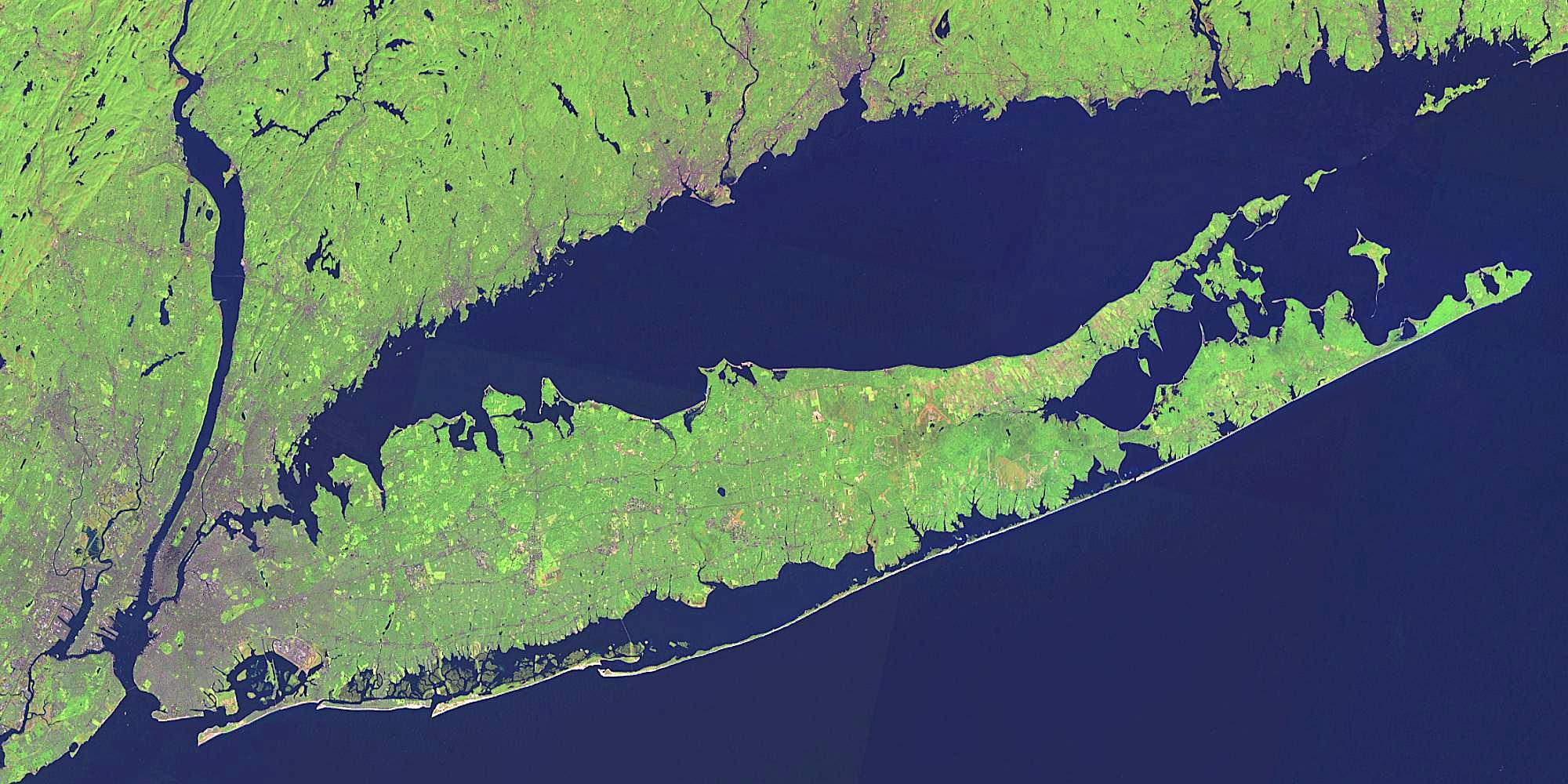
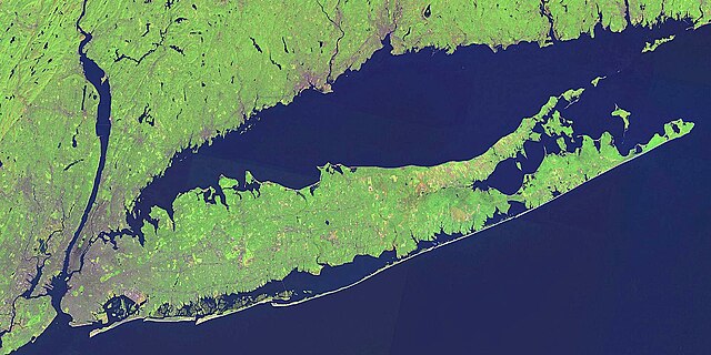
English: NASA Landsat satellite global mosaic image of Long Island, New York
Source link: [1] (Image was color corrected.) |
| Ffynhonnell | |
| Awdur |
Trwyddedu
| This file is in the public domain in the United States because it was solely created by NASA. NASA copyright policy states that "NASA material is not protected by copyright unless noted". (See Template:PD-USGov, NASA copyright policy page or JPL Image Use Policy.) | ||
 |
Warnings:
|
Cofnod lòg yr uwchlwythiad gwreiddiol
The original description page was here. All following user names refer to en.wikipedia.
- 2007-05-06 18:58 Dhaluza 2000×1000× (352107 bytes)
- 2007-05-06 18:33 Dhaluza 2000×1000× (283707 bytes)
- 2007-05-06 18:30 Dhaluza 2000×1000× (208921 bytes) [[NASA]] [[Landsat]] satellite global mosaic image of [[Long Island]], [[New York]] Source link: [http://wms.jpl.nasa.gov/wms.cgi?request=GetMap&width=2000&height=1000&layers=global_mosaic&styles=&srs=EPSG:4326&format=image/jpeg&bbox=-74.25,040.5,-71.8,0
Hanes y ffeil
Cliciwch ar ddyddiad / amser i weld y ffeil fel ag yr oedd bryd hynny.
| Dyddiad / Amser | Bawdlun | Hyd a lled | Defnyddiwr | Sylw | |
|---|---|---|---|---|---|
| cyfredol | 19:32, 25 Ebrill 2009 | | 2,000 × 1,000 (344 KB) | Urdangaray | {{Information |Description={{en|en:NASA en:Landsat satellite global mosaic image of en:Long Island, en:New York Source link: [http://wms.jpl.nasa.gov/wms.cgi?request=GetMap&width=2000&height=1000&layers=global_mosaic_base&styles=& |
Cysylltiadau'r ffeil
Mae'r 1 tudalennau a ddefnyddir isod yn cysylltu i'r ddelwedd hon:
Defnydd cydwici y ffeil
Mae'r wicis eraill hyn yn defnyddio'r ffeil hon:
- Y defnydd ar als.wikipedia.org
- Y defnydd ar ar.wikipedia.org
- Y defnydd ar arz.wikipedia.org
- Y defnydd ar ast.wikipedia.org
- Y defnydd ar bg.wikipedia.org
- Y defnydd ar br.wikipedia.org
- Y defnydd ar ca.wikipedia.org
- Y defnydd ar ceb.wikipedia.org
- Y defnydd ar cs.wikipedia.org
- Y defnydd ar de.wikipedia.org
- Y defnydd ar de.wikivoyage.org
- Y defnydd ar en.wikipedia.org
- List of peninsulas
- Barrier island
- User talk:DCrazy
- User talk:Meadowbrook
- User talk:Ric36
- Outer Barrier
- User talk:Solenoid
- User talk:Spongy-Anime
- User talk:MetsFan153
- User talk:Sullynyflhi
- Wikipedia:WikiProject Long Island
- Wikipedia:WikiProject Long Island/newsletter/4-5-08
- User talk:Raina noor
- User talk:Sinclair34
- User talk:Barkjon/Archive 2
- Wikipedia:WikiProject Long Island/newsletter/Archives
- User talk:RyanCross/Archive 4/4-6-08
- Wikipedia:WikiProject Long Island/newsletter/04-07-08
- Wikipedia:WikiProject Long Island/newsletter/04-09-08
- Wikipedia:WikiProject Long Island/rightpanel
- User talk:RyanCross/Archive 5/4-13-08
- User:EdGl/mxpx
- User talk:DanTD/Archive. April 2008
- User talk:Mitchazenia/Archive14
- User talk:RC-0722/Archive 2
- User talk:ClockworkSoul/Archive16
- User talk:Oanabay04/Archive 2
- Y defnydd ar es.wikipedia.org
- Y defnydd ar et.wikipedia.org
- Y defnydd ar eu.wikipedia.org
- Y defnydd ar fa.wikipedia.org
- Y defnydd ar fo.wikipedia.org
- Y defnydd ar fr.wikipedia.org
Gweld rhagor o'r defnydd cydwici o'r ffeil hon.