Monroe County, Pennsylvania
Sir yn nhalaith Pennsylvania, Unol Daleithiau America yw Monroe County. Cafodd ei henwi ar ôl James Monroe. Sefydlwyd Monroe County, Pennsylvania ym 1836 a sedd weinyddol y sir (a elwir weithiau'n 'dref sirol' neu'n 'brifddinas y sir') yw Stroudsburg.
 | |
| Math | sir |
|---|---|
| Enwyd ar ôl | James Monroe |
| Prifddinas | Stroudsburg |
| Poblogaeth | 168,327 |
| Sefydlwyd | |
| Daearyddiaeth | |
| Gwlad | |
| Arwynebedd | 1,599 km² |
| Talaith | Pennsylvania |
| Yn ffinio gyda | Wayne County, Pike County, Sussex County, Warren County, Northampton County, Carbon County, Luzerne County, Lackawanna County |
| Cyfesurynnau | 41.06°N 75.34°W |
 | |
Mae ganddi arwynebedd o 1,599 cilometr sgwâr. Allan o'r arwynebedd hwn, y canran o ffurfiau dyfrol, megis llynnoedd ac afonydd, yw 1.5% . Yn ôl cyfrifiad y wlad, poblogaeth y sir yw: 168,327 (1 Ebrill 2020)[1][2]. Mewn cymhariaeth, yn 2016 roedd poblogaeth Caerdydd yn 361,462 a Rhyl tua 26,000.[3]
Mae'n ffinio gyda Wayne County, Pike County, Sussex County, Warren County, Northampton County, Carbon County, Luzerne County, Lackawanna County. Cedwir rhestr swyddogol o henebion ac adeiladau cofrestredig y sir yn: National Register of Historic Places listings in Monroe County, Pennsylvania.
 |
|
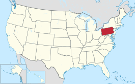
| Map o leoliad y sir o fewn Pennsylvania |
Lleoliad Pennsylvania o fewn UDA |
Ceir sawl sir o’r un enw gan gynnwys:
- Monroe County, Alabama
- Monroe County, Arkansas
- Monroe County, Efrog Newydd
- Monroe County, Florida
- Monroe County, Georgia
- Monroe County, Gorllewin Virginia
- Monroe County, Illinois
- Monroe County, Indiana
- Monroe County, Iowa
- Monroe County, Kentucky
- Monroe County, Michigan
- Monroe County, Mississippi
- Monroe County, Missouri
- Monroe County, Ohio
- Monroe County, Pennsylvania
- Monroe County, Tennessee
- Monroe County, Wisconsin
Trefi mwyaf
golyguMae gan y sir yma boblogaeth o tua 168,327 (1 Ebrill 2020)[1][2]. Dyma rai o'r dinasoedd, trefi neu gymunedau mwyaf poblog y sir:
Rhestr Wicidata:
| Tref neu gymuned | Poblogaeth | Arwynebedd |
|---|---|---|
| Coolbaugh Township | 20805[4] | 88 |
| Stroud Township | 19834[4] | 31.5 |
| Chestnuthill Township | 16723[4] | 37.6 |
| Middle Smithfield Township | 16053[4] | 54.2 |
| Pocono Township | 10884[4] | 34.4 |
| East Stroudsburg | 9669[4] | 2.86 7.408004 |
| Hamilton Township | 8597[4] | 38.5 |
| Tobyhanna Township | 8315[4] | 52.6 |
| Smithfield Township | 7967[4] | 23.9 |
| Polk Township | 7473[4] | 31.4 |
| Tunkhannock Township | 7037[4] | 38.9 |
| Jackson Township | 6578[4] | 29.8 |
| Arlington Heights | 6331[4] | 13.924083 |
| Stroudsburg | 5927[4] | 1.74 4.511566 |
| Ross Township | 5475[4] | 22.7 |
Cyfeiriadau
golygu- ↑ 1.0 1.1 https://data.census.gov/cedsci/table?t=Populations%20and%20People&g=0100000US,%241600000&y=2020. Cyfrifiad yr Unol Daleithiau 2020. golygydd: Biwro Cyfrifiad yr Unol Daleithiau. dyddiad cyrchiad: 1 Ionawr 2022.
- ↑ 2.0 2.1 https://data.census.gov/cedsci/table?t=Populations%20and%20People&g=0100000US,%241600000&y=2020. Cyfrifiad yr Unol Daleithiau 2020. golygydd: Biwro Cyfrifiad yr Unol Daleithiau. dyddiad cyrchiad: 1 Ebrill 2022.
- ↑ statswales.gov.wales; adalwyd 25 Mawrth 2020.
- ↑ 4.00 4.01 4.02 4.03 4.04 4.05 4.06 4.07 4.08 4.09 4.10 4.11 4.12 4.13 4.14 https://data.census.gov/cedsci/table?t=Populations%20and%20People&g=0100000US,%241600000&y=2020
